

Written by Aleks Kashefi - https://pursuingthevoid.wordpress.com
“So, when are we actually going home?” he asked
“You’ve seen the schedule haven’t you?” I replied
“Yes, but when are we actually going home? You’ve got over a hundred miles to cover.”
“I’m finishing this thing Wednesday.”
“No you’re not. When are you planning on finishing? I hate camping so when do I get to go home?”
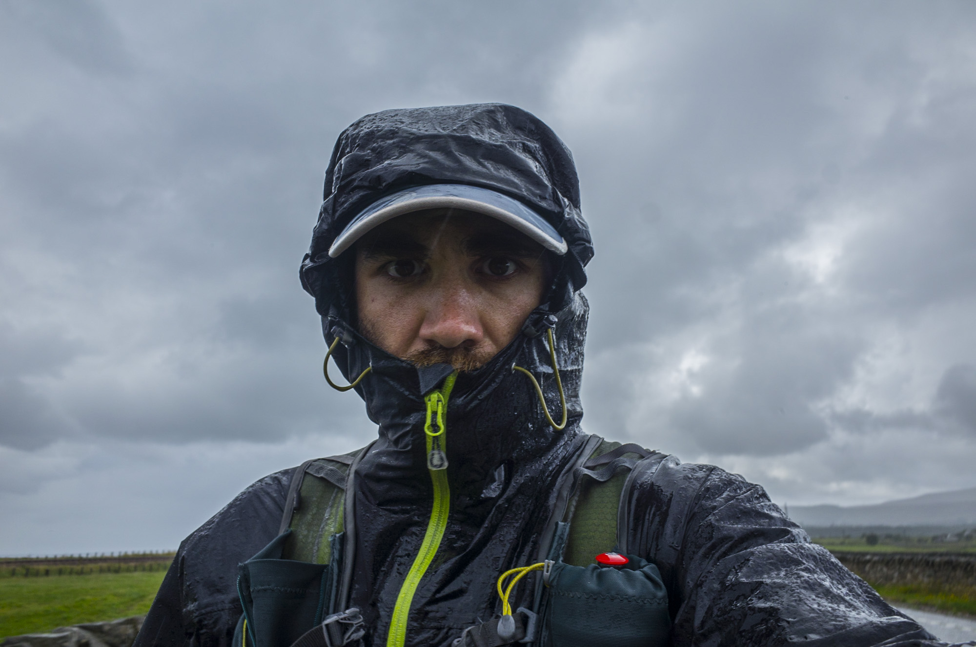
The weather was poor at the start and poor at the end. It didn’t matter though. I’d said that I’d finish on the 2nd and that’s what I was going to do.
But I get ahead of myself, how did I get to the North of Scotland? How can I share, what was an epic journey for me, the scale of the undertaking in a way that doesn’t fill page upon page with thousands of words?
I’ve tried 3 times to make this a concise post on the experience of running LeJog (Lands End to John o’Groats). The problem lies with the fact that it was 38 days, or 35 days of running with lots of different things happening on the majority of days, so I’m going to compress the days into sections of trails to give an idea of what it was like to run, unsupported from one end of the country to the other.
Starting on the South West Coast path meant that navigation was actually fairly easy. Just keep the sea on your left. Occasionally you end up following a desire line (the sections of trail that cut corners or wander off away from the trail only to re-join them later on) or getting carried away on a downhill route, but generally it didn’t take long to realise that the route I was on wasn’t quite right. I even started to try and find more direct routes from A to B as I realised the frustrations of running along fractals! The SWC follows the coast so tightly that in parts a marked 3 mile route would take an hour of running, so I learnt to ignore the distances early on and just focus on place names. You may think that finding drinking water and food was easy, but actually, staying on the coast path you won’t see many shops or places for food. The LifeStraw water filter I was carrying meant I could drink from most for the puddles and streams, but this is where I started to drink less than is normally recommended. It was a balancing act between the weight of the pack and the discomfort of being thirsty. Bigger towns like St. Ives were a good place to stock up or just gorge on food before moving on. The SWC path is incredible to run along and it shouldn’t be seen as being flat, since the day with the most climb per mile was along this glorious bit of trails.

Finding Sleeping spots became easier, and on some nights you’d bump into kind people who’d recommend a glorious spot like this one (thanks Keith)
Then there’s the weather and tide times. If you’re lucky, there won’t be any rain or wind. If like me you aren’t, be ready to be blown around a fair bit and to get wet. But there is a distinct advantage to running the coast. If you get tired or bored of the winding, technical and hilly routes you have the option of running along the sandy beaches and do a little bit of scrambling along the rockier parts of the coast. If you know the tide times, then they make for a fun game of beat the tide, as you see how far you can get before the tide forces you back on to the coastal path. It was along this path and early on that I picked up the first of two injuries.

It’s possible to carry on moving with lots of injuries, but this one led to tendonitis in the opposite leg! Compensation injuries suck.
The gales on the second day had a tendency to catch me off guard and on one of them I was running towards a rock stile and got pushed off balance, catching the top of my foot on the rock. It did what most body parts do if you hit them hard enough. The swelling was fairly impressive and egg shaped, but it didn’t affect my running, or so I thought. I lucked out on the camping sites and managed to get a few good sleeps in, although not having seen any of the trails or areas I ran through (this was the case for everywhere I went apart from the stretch between Bakewell and Hathersage) it took me a while to get the whole skill of finding a suitable sleeping spot sorted. The best way is to use Googlemaps on satellite view and locate a field that is sheltered from view and if the weather is dire, sheltered from the weather.

The worse spot I found to sleep. I was paranoid all night that someone would return!!
There are a few sections along the coast path that can’t be crossed at high tide (like the section between Crantock and Newquay) so those tide times come in handy and you can buy a book cheaply with a years’ worth of tide times in!!

The beach at Crantock at low tide makes for a short route to Newquay. Otherwise your choice is to swim or head in land and on to the roads.

Luckily the tide was out enough to cross the estuary and get up and out towards the SWC in Newquay.
But I’m getting side tracked…

The euphoria of reaching the end of a day and being on track with your schedule. Upper parts of Closely.

Clovelly is a delightful little place, where you either go steeply down or have to crawl up.
The journey takes you to Clovelly and this is the first part where you notice a distinct change in the terrain. Gone are the rocky technical trails. They’re replaced by mud and dirt trails with larger rocks that occasionally poke out the ground. There are still some of those awesome hills to run down and up which makes arriving at the mouth of the estuary and Barnstaple a bit of an anti-climax. 5 days in I arrived at Barnstaple and up until the last few miles I felt great. Crossing the estuary along the A39 I could feel my right calf getting tighter and an annoying ache developing at the point where the Achilles tendon joins the Soleus muscle. Here’s injury number two…. Tendonitis!

This was the moment when I had to decide whether the journey was over or not. Luckily a friend sent me a message that did the trick. Thanks Amy.

Sometimes you just have to make the most of a shit situation. Thanks to some friends, the injury could be forgotten for a bit.
I managed to hook up with an old friend and then spent the next day working out whether this was the end of the trip. With a swollen foot on one side and tendonitis on the other I wasn’t sure if I should carry on with a schedule that was around 35 miles every day, so, I changed the schedule. This is probably key to people completing or failing a LeJog. I was really hell bent on sticking to the route and the schedule until that point. After it I seemed to adopt a nice daily routine and it must have been a good one. I finished 31 days later. So, here’s there routine that seemed to develop organically. Wake up around 5:30am, check the schedule for place names and then plant the route. The planning of the route involved plotting waypoints on the OS map app and making a mental note of the overall mileage. Next was packing the equipment and getting it in the pack in a specific order to minimise the size of the pack and make it comfortable to carry. Tent was always packed away last. The days running and walking was done at my leisure. It was my holiday time after all, so if I wanted to sit and have a coffee in a cafe or a drink in a pub I did do. I found the combination of half a pint of beer, a pint of cola and a pack of pork scratchings to be the perfect pick me up before doing any part of a route that I knew would be difficult. The navigation was done by memorising small 1-3 miles sections and just going along them until I either reached the end of what I remembered or I needed to be sure that I was heading in the right direction. I even managed to navigate across Exmoor using the most basic road map ever. I have to say I loved my compass that day.

Exmoor. Completely different to the SWC path and the start of some good weather.

Finding those hidden places on open access land made up for the excruciating pain of the hugely swollen Achilles tendon on my right foot.
The days had a tendency of blending into each other and the coping strategy of not focusing on the entire journey and only small sections, meant that I could never really say where I started a day or two before. The tendonitis was managed using a stout wooden walking stick that I picked up somewhere on a hill in Exmoor. It was the most Lord of the Rings stick I could find and being a fan of the Hobbit, a fair few quotes were randomly shared with any vegetation or animal that was close enough to hear me.

Sleeping spot at Wheedon Cross. I actually could decide where to sleep it was such a big space!

Eating left over roast potatoes thanks to the kind folks at Wheedon Cross. Exmoor has some great woodland trails.

Typical of the Exmoor I saw. Big rolling hills and woodlands. And lots of dried out thistles!
This is where the weather improved and then got warm! The Somerset flats were like running in an oven and with the constant change between footpath and road, my feet were either comfortably cold or burning hot. As you hit Exmoor and move away from the coast you get farms. This is where you can feast on fruit, vegetables and eggs, and all at a really low price. Little stalls with honesty boxes are the only reason I managed to find food as I made my way to Cheddar, since most of the villages and hamlets didn’t have shops or… The shops didn’t open until I was a fair few miles away.

The night before reaching Cheddar. Great little hidden spot and a glorious sunset.

This is where the animals have a tendency of following you around a field. Be ready to be a cow or sheep magnet!
 F*@% out of it!"" height="779" width="584">
Adhoc physio to try and reduce that egg on my foot and help deal with the tendonitis. In the words of my physio friend Nick, ‘Squeeze the F*@% out of it!”

Heading away from Cheddar and towards the Severn Bridge.
The flatness made this part of the trip a little monotonous but at the same time you can cover a good amount of ground without the strain of running hills. That is until you hit the Cheddar Gorge. If you get there, go over it. The view was amazing, even in under the grey sky that threatened me with yet more rain. Apart from the view, going up a big hill always means running down the other side, and the descent was fun! Even running with a gnarly walking stick didn’t seem to matter, and then it was back down and along flat trails. The days that followed were all about getting from A to B. the A and the B didn’t really matter and I think I must have completely zoned out. I don’t actually remember where I went through at all. That is until one of those moments that make everything worthwhile…

I realised that regardless of how much I disliked the urban sections, they still provided some great views.

A hidden gem along that you won’t find unless you leave the Offa’s Dyke path and explore. Don’t expect to find footpath though, since no one uses them anymore.

The final trig on the Black Mountains. Didn’t have to bag this one, but I’m so glad I did.

View of the sky at Hay-On-Wye

A classic Offa’s Dyke path Style on route to Knighton.


Sometimes, you just have to take a nap. doesn’t matter where since there never seemed to be any people about!
One of these moments happened on the trail that meanders along Wenlock Edge. Lots of woodland trails and if you move quietly enough you might be lucky enough to walk or run along with deer. I was amazed at the way they moved up the hill like I wasn’t there and wish I hadn’t decided to try and take a picture. Before I did, I walked up the hill with them about 2m from me on a higher section of the path, side by side. All I can say is that if you see it in a film and think “stuff like that never happens”, it does. One of the best memories of the trip, even though it only lasted about 2-3minutes max. The next few days seemed to fly by. Before I knew it, I had crossed the river Severn, experienced the wonder that if the Offa’s Dyke path (especially leading from Chepstow to Monmouth), met up with some really old friends and I was in Yorkshire and heading towards the North and Scotland. The tendonitis had improved by managing the amount of walking and running I did. I forced myself to walk lots of sections, reminding myself of the agony of walking across Exmoor and towards Cheddar. Now, research the Pennine Way and you should make sure you pay attention to the word BOG! The first sections are glorious to run and walk, with good ground beneath your feet, lots of places to stop for food and drink and plenty of water sources. The section through the Somerset flats had little to no suitable drinking water. That were I realised that the 2l of water recommendation didn’t seem to be true for my body. The litre to litre and a half I drank per day didn’t leave me with that dehydration ache that you can get after or even during a race. I managed the swelling of my feet by wrapping each foot in a bike inner tube, moving the foot backwards and forwards for about a minute before repeating it with the other foot, and purposefully sleeping with my feet higher than my head. But again I’m off on a tangent, so back to the Pennine Way…

Sunrise at Abbots Bromley, with the next stop being Bakewell.


Meal curtsy of Bob at The Outdoor Stations and Backpackinglight.co.uk
The strategy was simply ‘eat when and where you can’

The Pennine Way, before I realised it was most BOG!


One of many pub stops, but this one was one near home and with my Uncle who has a tendency of erm… speaking his mind ;)


Hadrian’s Wall is such fun to run along but the boggy sections after are likely to wipe it from your short term memory. All I remember thinking to myself was, I will be in Scotland tomorrow and despite being tired, I plotted and followed my route through Bellingham and up on to the Cheviots. The views were great and it was good to jump over the gate that marked the boundary between English and Scottish soil. I headed down out of the hills and made my way to Jedburgh the first Scottish stopping point.

The last section of England up on the Cheviots.

Post Jedburgh sunset. A miscalculation of distance meant a night in a field next to the A9. It was just ever so slightly noisy.

The Forth Firth from the road. Luckily to have had this view, since after the earlier sections, the road would have been should destroying otherwise.
Amusingly, a person in the pub mistook me for someone who was homeless and told me that I should get my pint and make sure I don’t leave my bag behind as I leave the pub to drink outside! At the time I had no idea what he meant, and it’s only the sign on the back of my pack that let him know he was being a bit of a ‘prat’, which got quickly followed by the people he was drinking with ripping into him with little jibes. For some reason I decided to have a day off after Jedburgh. I’m not 100% sure that I needed the break, but something in my head convinced me that it was a good idea, and I spend the next day replanning my route. Why? Because my dear friend and constant source of common sense and information, Pete Ambrose nagged me until I did.
Extract of conversations with the home support guru…
Pete “Do you want me to see if there is a shorter straighter route? Is that the question?”
“I guess yeah” Aleks
Pete “Keld to John O’Groats via the Cicerone route is 580 miles…”
“on the road via google maps, 410 miles”
“Choices Choices.”
Pete “Look at this for a beautiful clean line
http://www.hockeylejog.co.uk/map.htm
http://www.hockeylejog.co.uk/journal6.htm
Route from Edinburgh to JOG
Thank the Rustons for this.”
“I’ll get the maps and start looking at some point. Struggling to move legs today.” Aleks
Pete “Are the legs stuck in a bog?”
“No, but probably aching because of the bog trotting. Slow day today” Aleks

Mr Ruston on holiday. It was great to see people I knew along the way, and I gladly waited for them if I was ahead of schedule. It made the trip worth while in some ways.

Why is bad weather good? Because it give you sunsets of incredible beauty!
I wanted to get back home a little earlier and actually spend a bit of time enjoying the experience, as opposed to getting back and going straight into work the next day. This is where I became more of a road runner, with the odd trail thrown in to stop me going insane. Still, the route I followed provided some amazing views and gave me the change to cut straight through the Cairngorms. The start of the Cairngorms was ok, the middle was dire (bogs, wind and rain that actually got me cold enough to find it difficult to move my arms) but then, the little stormy section of weather blew over and gave me some of the best views of the whole LeJog trip. This is where I stared to get a little flippant with the mileage. From Jedburgh to John O’Groats I averaged around 38-40 miles per day, finishing around 6-7pm each evening. With 4 days left, I decided to cut a 38 mile day down to 18!! Why? Laziness I guess.

The wooded section from Blair Athol on route to the Cairngorms. Have to say it was all pleasant, even with the freezing weather!


The storm that blew over as I reached the 912m peak of the route. It was more like winter than summer.

The joy of being off the bog and having glorious sunshine!

Scotland has to be the land of rainbows. I’ve never seem so many in so few days.

Barefoot running sometimes results in a hippy look! Flowers between toes is a barefooting hazard.
The thing is, our bodies and brains, once we let them know who is boss, will do what we want them to. Especially when we pay attention to what they are feeding back and understanding it. What did this look like in reality? It looked like 3 days that would normally be seen as this isn’t happening, time to rest and wait a day or two…


The 2nd to last day and the road was dull! Occasionally, the view was grand in its simplicity.
Sunday I managed to cover 38 miles along the A9. Not the nicest route, but there are no trails in Scotland that go north!! They all seem to go from East to West, so being on the East coast, this was my only option. Then I had ‘that’ conversation with my Uncle, who joined me to run some sections as the reason for my run was also close to his heart.
“So, when are we actually going home?” he asked
“You’ve seen the schedule haven’t you?” I replied
“Yes, but when are we actually going home? You’ve got over a hundred miles to cover.”
“I’m finishing this thing Wednesday.”
“No you’re not. When are you planning on finishing? I hate camping so when do I get to go home?”
I repeated my answer and he insisted that I’m wasn’t going to cover the distance in 3 days and finish a day earlier than my projected finish day. So, I guess it was time to prove a point…
Monday was a 36 mile day and a 6pm finish, followed by a Scotch egg and fish and chips supper. 12:30am however, the meal and scotch egg returned to haunt me. I managed to get food poisoning with only 2 days left. I had around 3 hours sleep that night and felt like a large sack of horse manure that had been repeatedly beaten with a large stick. Despite this, I packed everything up, mixed up the trusty Tailwind that had been my main source of calories and got moving. Around 10 miles later I reached Brora, found a cafe (which my Uncle and Stepfather had already found and where happily sat in drinking a warm drink) and managed to drink half a coffee, borrowed their car key, got in the car and slept for an hour and half. After this it was a case of picking somewhere to end for the night. Helmsdale got the thumbs up and I got my focus head on (assisted by a swig of Gaviscon, 1 pro-plus tablet and 2 ibuprofens) and headed out. I only managed 28 miles that day, but they felt like 38 with the stomach cramps and lack of sleep. That left 55 miles between me and John O’Groats and not surprisingly my Uncle repeated his question. I just replied, I’m finishing tomorrow, but I’m leaving early.
Little did I know that a delightful French fella in the hostel they booked me into was going to keep us up most of the night, with his constant wailing, wandering and generally making us think that he may be an axe wielding maniac, so with around 3-4 hours’ sleep I got out of bed, spend 3 hours waking my brain up with coffee and beans on toast and set of at 9am. It was the last day, I didn’t care whether I could repeat a long day the day after, and so I actually had the option of running with no consequences. Around 20 miles in I had a leisurely pit stop at a cafe, enjoying a scone and carrot cake with a pot of coffee, and I took my time over it. I was in there for an hour and a half smile J
The rest of the day was just determined footsteps. The wind was blowing in from the North and like the start it was raining, but after so many days it really didn’t matter. A quick 15 minutes of sleep at Watten and it was time to cover the last 19 miles. My Uncle joined me. He’d intended on running the last section and it was good to have him there. We reached the Northern coast with 4 miles between me and that fingerpost. The adrenaline must have been flowing because I picked up my pace and managed a spritely 6 minute mile on the final mile. It was done and the time for a celebratory whiskey or two had arrived. The nice thing was, that I started with two old friends and ended with two other old friends. My Uncle insisted that we drink all the whiskey (a bottle and a half) so we stayed up till around 3am, got into my trusty tent and went to sleep on the road for the last time, as part of the adventure.


The morning after with a coffee and some food. It was time to plan the next adventure or two.

Posing like a nit wit at the finger post.
I wouldn’t actually change a single bit of it, even the early injuries. They made the learning curve steep, switched on the important aspect to of my thinking, problem solving on the fly, and let me meet lots and lots of people.
I’ve just looked at the word count!!! I may owe some an apology if they’ve ready this far. I’ve not even looked at the screen as I’ve been typing so I apologise for the quality or lack of in the writing. I have to say that the conversations with Pete Ambrose along the way had a way of focusing the thoughts, so the tip for any adventure is to get yourself a sounding board. Someone that will tell you you are being a total tit, occassionaly enquire about your state of mind or health and generally make sure that your feet stay on the ground and your head out of the clouds.
If you’re wondering what the different parts were like, stay tuned for a later post where I publish some of the 500+ photo’s I’ve taken along the way.
Next up though, I’ll focus on the kit I took and luckily there wasn’t much of it.