

Written by Tom Wright - http://life.tomwright.me.uk
I am officially a Nutter!
Well, my six year old probably told me that the first time I headed out for a training run at midnight. But the other weekend it became official as I completed my first mountain ultra organised by Might Contain Nuts. A moniker duly placed on all runners as the organisers announced on their Facebook page: “OK, Nutters, take note, pack away the shorts and short sleeve Tee’s of recent days, weather looking interesting!”
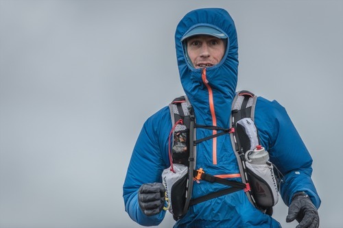
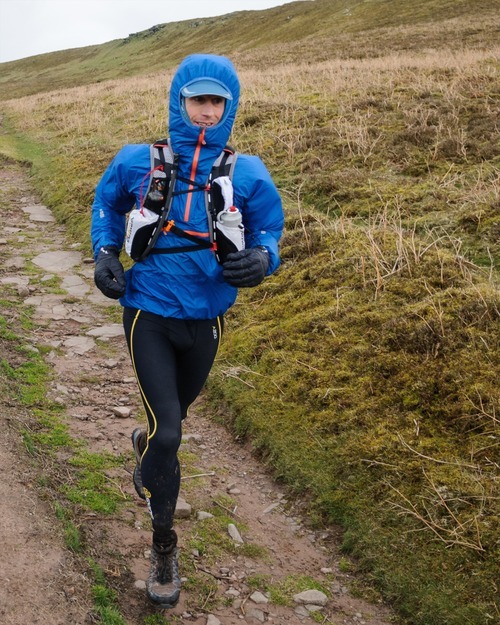
Nutter coming! Wrapped up and ready to take on the Welsh elements. Photo copyright Jon Phillips at Muen Photography.
Interesting indeed! Only in Wales could we get snow, hail, wind, rain and sun all in one day. I was genuinely worried. My passion for mountain running was born on the slopes of Montgo - a rocky outcrop on the Costa Blanca of similar elevation to the Black Mountains but generally swathed in hot Spanish sunshine. My body was not hardened to the hostile cold of a Welsh mountain. This event wasn’t even on my radar until four weeks prior when my original challenge, 50 miles of North Devon coast, was cancelled. At 2800m the vertical gain was comparable, just crammed into 10 less miles.
So come Friday 21st March I set off for south Wales with a fully loaded Salomon slab vest. Loaded was an understatement since, as with all races in the Welsh Ultra Running Series, the Black Mountains Ultra was a self-supported race. Not only did I have to estimate how long it would take to cover the 40 miles of steep sided glacial valleys but I also had to do the calorie sums and pack food accordingly. Plus, the meteorological downturn in an otherwise spell of fair weather, meant the word optional had been removed from all recommended kit.
In previous years the course had been 33 miles, except when severe snow reduced it further. This year we would get extra value for money with 40 miles. This allowed the course to circumnavigate the Black Mountains range, which incidentally sit on the far eastern edge of the Brecon Beacons hugging the English border. We would have six major climbs with the largest being around 1750 feet, a variety of moor, woodland track and high plateau running and a whole lot of mud!
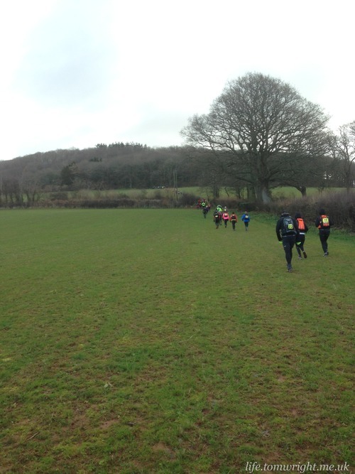
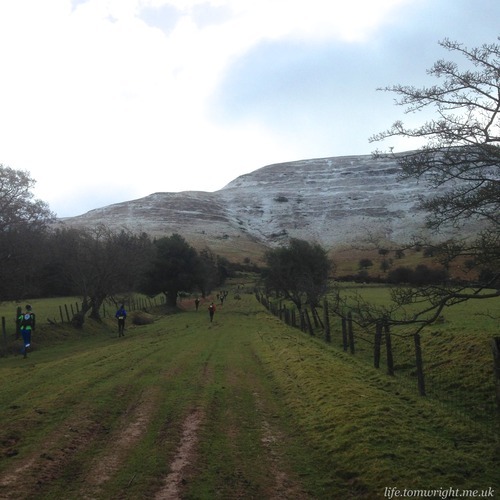
First climb into the woods…
There wasn’t even a gentle warm up as Matt warned us in the briefing that the first 5 miles are horrendous. He even apologised! One mile in and my Roclite 315s had turned a rather putrid brown colour.
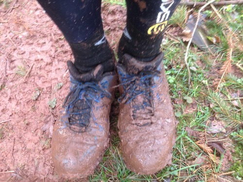
Some Black Mountains mud? Nope, haven’t even reached the mountains yet…
It was up all the way. Slowly at first as the muddy trails gave way to furrowed fields before the trail turned rocky and we began the long ascent onto the snow covered plateau.
Keeping it cool before donning the winter mountain wear. Photo copyright Jon Phillips at Muen Photography.
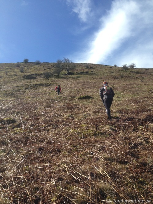
Four miles in and the proper climbing begins.
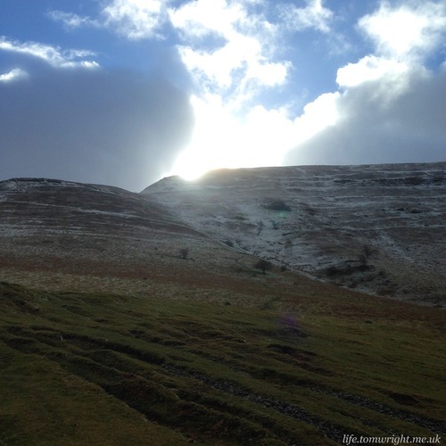
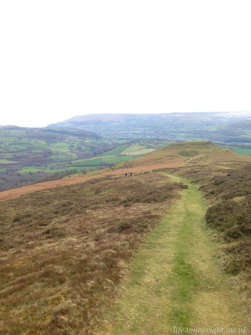
Sun! A good sign for the day’s weather perhaps?
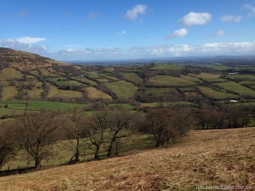
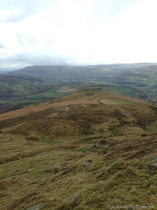
Looking north-east towards Twmpa (aka Lord Hereford’s Knob)
After 400m of climbing I discovered that no amount of hill reps on the Cornish coast could really prepare my legs for the mountains. Worse, my lower back ached from the burden of so much cargo. First five miles over so it must get easier on the plateau?
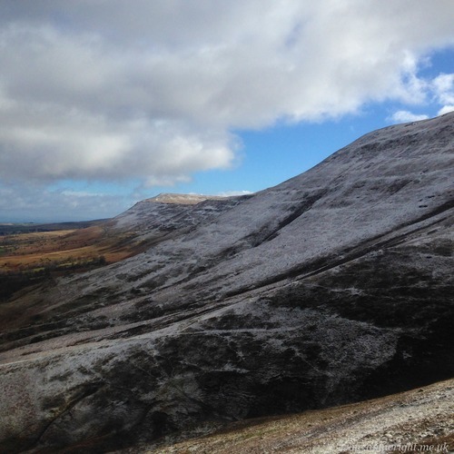
Nope! The terrain was waterlogged and at times my feet disappeared in the quagmire. I just hoped the shoes would drain quick and my Drymax socks keep my feet warm. I hadn’t room to pack spare socks. Lord Hereford clearly took a dislike to us ascending his Knob as we were engulfed by a heavy snow shower. Yes some of these mountains have unusual names. I had worked hard with my Welsh born fiancée on the pronunciation of the highest, and last peak of the day, Waun Fach, in case it came up in conversation!
No sooner did we cross the border into England the snow stopped and the sun emerged. The wind however was relentless and I nearly lost my waterproof cap as a gust sent it spiralling down a steep precipice. Fortunately it found shelter on a tiny ledge and I scrambled down to rescue it.
I am sure many runners will agree the trail above the Olchon Valley was stunning and the most enjoyable part of the whole course. The wide watery plateaus yielded to a steep sided ridge topped with large boulders. The sun was in our eyes, the wind slicing across us.
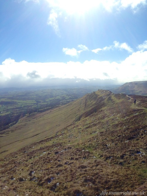
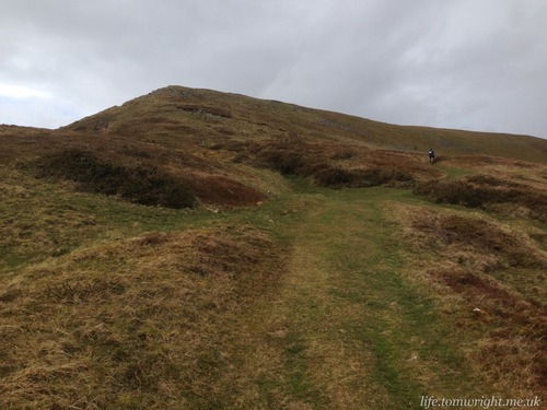
Time for some fun ridge running!
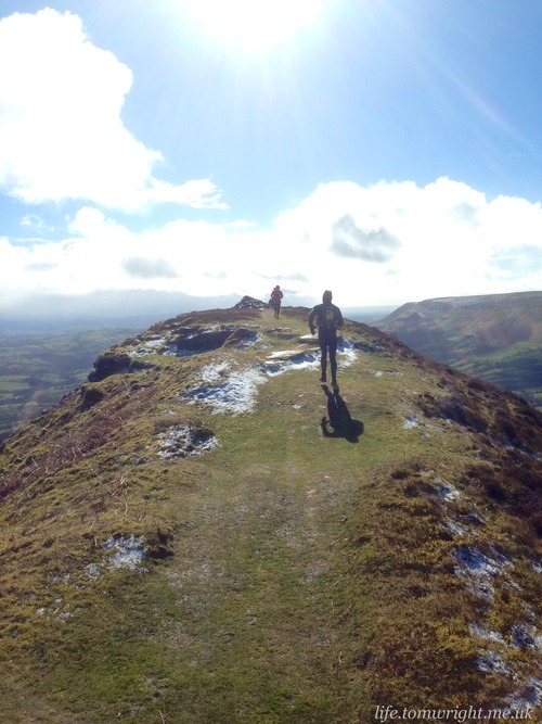
Windy… but sunny and stunning views
For a brief moment I could have been back in Spain as I flew over the rocks and down the path that led to our third checkpoint of the day. In the boot of the marshall’s car was a veritable feast of goodies. I munched a handful of nuts preferring to save my own food for when it might be most needed.
For the next 15 miles I shared my time with Madoc. A veteran, both in age and experience with the likes of TDS on his résumé. No sooner had I declared my intent to use this race to prime my navigation skills ahead of the 10 Peaks, we discovered we had deviated from the course! We picked up a fellow stray and battled our way through undergrowth as we tried to relocate the route. The obvious, but certainly not the sensible, option was to go straight up and I proposed a path over a barb-wired fence and through some brush. It was steep!
Views into England… and our wayward course
This would have been a perfect time to recall my Geology lessons that taught me glacial valleys are concave, a point illustrated clearly by the ever decreasing space between contour lines on the map.
Seemed like a good idea at the time. Half way up and it most certainly was a VERY bad idea!
Sure enough we were soon scrambling on our hands and knees entangled in thorny and sometimes rocky scrub. My legs were cramping, my pace was around 40 min/mile and the top was still some way off. Choosing to take short switchbacks to ease the exertion on my weary muscles I soon lost contact with the other two.
Finally back on the plateau the trail followed Offa’s Dyke. No need for boundary walls here the steep sided hills were more than enough deterrent. I was reduced to the ultra shuffle. Countless runners I had overtaken earlier in the day passed by. Only 13 miles in and it felt like my race was over. First low point of the day!
Fortunately we were soon heading downhill again. A long steep descent with the reward of stunning views up the valleys and the remote Llanthony Priory our destination. An impressive derelict abbey from the 12th century that must have been quite a target for the Welsh with strategic hills all around.
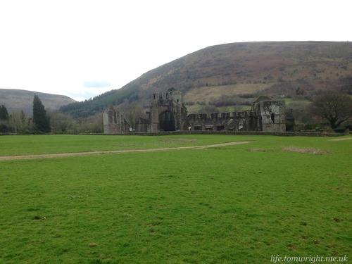
Lost in time in a glacial valley - Llanthony Priory.
My historic fantasies were rudely interrupted by another long climb. This time we cut up a sheltered river valley, the steep and winding path broken up by large boulders. For once the wind that had battered us all morning would have been welcome as the sun beat down and I began to sweat heavily. Didn’t see any point stripping off. We would soon be exposed again on another peak. The slow plod that had become the norm on the ascents soon became a canter as I headed straight back down the other side through some boggy wasteland which gave way to the woodland tracks of Mynydd Du Forest.
The far side of Grwyne Fawr my map skills were called upon as a sign directed us into no mans lands. I was very much in the zone, running alone and trying to make up some time so quickly took a bearing confident that I knew where I was on the map. A mile later and the lack of signs had me feeling uneasy. Worse I turned around to see five fellow runners following me on my wayward peregrination. Madoc included! Now, in retrospect, I ask myself why did I not switch my Ambit to map mode to ascertain my location. Mental exhaustion and poor decision making were playing a big part in my day. The 3am baby feed probably didn’t help - not that I sleep the night before a race anyway!
Working together, and with the help of Madoc’s GPS phone app, we fixed our location. My initial bearing had been correct but we had come out of the forest way off course. So another hike through overgrown scrubland followed as we slowly dragged ourselves up a valley to a trig point which finally got us back on route. The Beacons Way would be our guiding track down to Llanbedr and the 25 mile checkpoint. The wind was consistently fierce now and must have been approaching the minus twelve forecast by the Met Office. I had adorned a polar Buff in balaclava style, zipped my Montane Smock tightly and buried my hands in Montane Prism gloves. It was snug! I was feeling ravenous though and it was far too cold to take my gloves off to rummage around my pack for food. I told myself I would hold on till I got into the shelter of the valley.
On the Beacons Way as the wind-chill dropped well below zero. Montane gear working some warming magic! Photo copyright Jon Phillips at Muen Photography.
So, another hasty descent to the checkpoint where I was greeted with a delicious bag of mixed fruit and nut. Did I really need to carry over a kilo of food with me? Most of my nutrition had come from the checkpoints after all. I scoffed down three handfuls then dug out a white chocolate macadamia Clif bar from my pack. This was almost the marathon mark at 25 miles, except the GPS confirmed we had actually done 28 miles, with our wayward diversions, in 6 hours. Before heading out I stripped off my sweat drenched top in favour of an Inov-8 Thermomid. I suspected it was going to get very cold and the next checkpoint was 11 miles distant.
Time for the business end of the course - the Dragon’s Back. A stunning ridge that would lead us to the highest point of the Black Mountains. First we had the long 500m climb onto the ridge taking in the old hill fort of Crug Hywel and some stunning views south-east to the distinct stratovolcanic shape of Mynydd Pen-y-fâl (aka the Sugar Loaf).
Looking back to Crug Hywel hill fort.
And a bit more climbing still to go to reach the summit of Pen Cerrig-calch.
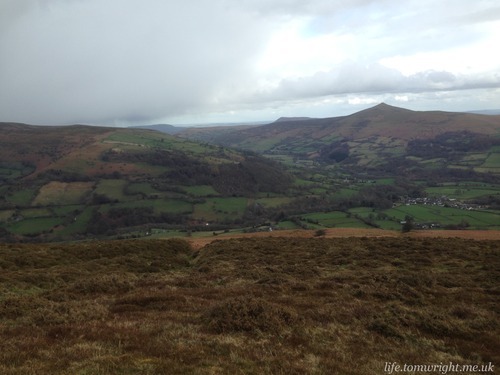
The Sugar Loaf - the prominent peak on the right of the photo.
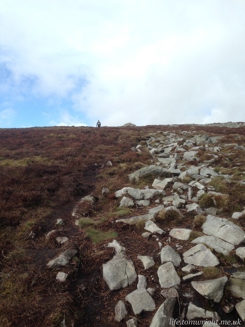
A very long… very slow… climb!
At first I walked with Madoc but gradually he drifted back and I was by myself by the time I reached Pen Cerrig-calch at 700m. I checked my watch. Seven hours. It had taken just under an hour to cover 2.25 miles! Looking back down the hillside runners seemed to all be moving at a similar pace. The Black Mountains’ steep sided slopes had taken a lot of casualties! I was determined to finish in under ten hours and reckoned on a four mile pace being enough to see me through. Any realisation of pace was hindered further by very uneven terrain. The path was strewn with large boulders making even grounding impossible and I knew with tired legs a trip could be fatal so I continued to walk.
An accessible trail runs parallel to the scattered boulders.
Finally the path became more assailable but on the level my legs were very unforthcoming. I took stock of my situation and surroundings. No one was making inroads on me and there was just one runner in red about half mile ahead along the ridge so I was very much alone. The skies to the west were turning dark and the wind was howling across my face. I felt exhilarated! I hadn’t come all the way to Wales to walk the Dragon’s Back. I plugged in my iPod for the first time, dropped a gel (which I had packed for just such an emergency), buried myself inside my smock and began gradually to pick up the pace. I smirkingly joked to myself… just Waun Fach to go!
In minutes the blue skies faded, the path weaved into the clouds and the hail began to fall. Well, it was more like someone was actually firing the hail against the side of my face. It was excruciating, but there was no where to shelter and I was on a mission. When the storm subsided and the clouds lifted the runner in red was only 200m ahead of me. I mistakenly took a steep 80m climb to Pen Trumau to be the final ascent to Waun Fach.
A steep sharp ascent which turned out not to be Waun Fach!
The long slow boggy ascent to the true Waun Fach. The runner in red now in my sights…
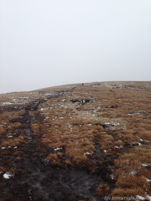
In fact the highest peak of the Black Mountains was uncharacteristically rounded. It was dusted with snow, the first I had seen since Hay Bluff six hours earlier. The snow simply concealing the bog that lay beneath. There was no hard ground. Just thick black mud which I cursed as I waded ankle deep through it. Cloud had descended again and visibility reduced to about 50 feet. Most inconvenient timing as a maze of paths, or waterways, scattered in all directions. But it was downhill all the way now. I hurtled passed the runner in red and then lost my footing falling sideways into the mud! Every so often a sign would appear out of the fog and I would breath an air of relief. Finally I broke out of the clouds onto the hard gravel track that cut down the mountainside to the checkpoint.
It is amazing what a bit of gravity, and another Clif gel, can do for the legs. I ran the last 6 miles from the summit of Waun Fach to the finish in Talgarth in 61 minutes, including a brief stop to fill my bottle at the checkpoint. And Might Contain Nuts had no intention of making those last few miles easy as the trail weaved through Pwll-Y-Wrach nature reserve. There was some seriously treacherous bouldering, plenty of thick mud and a most picturesque waterfall.
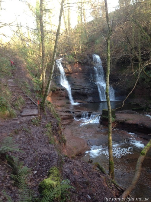
Sure the clock was ticking… but I couldn’t resist taking a photograph of this beautiful little woodland waterfall which provided a sharp contrast to the broad sweeping landscapes we had experienced for much of the day.
What really made me chuckle was the tiny little climb just 200m from the finish. Without the aid of gravity I couldn’t bring myself to run up it. Hadn’t we done enough climbing for the day? With diversions vertical gain was just shy of 3000m! The finish line came with the ringing of a cowbell. Within an hour I was sat in the bath with a cold Cornish ale musing over the 50 miles I would be tackling when I return to Brecon in May. (Hat tip Trail Running magazine’s posting on the proven benefits of light beer as a recovery drink)
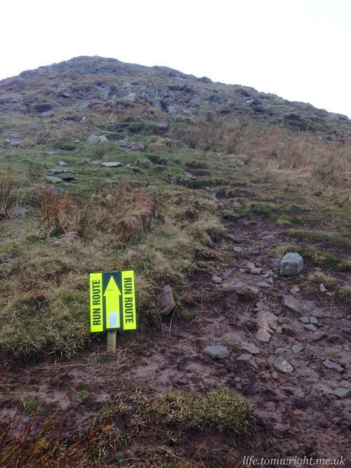
This was a fantastic day out! Far tougher than I could have possibly expected but ultimately achievable. The weather was extreme and added to the challenge. Huge respect to the marshals that were out on remote parts of the course for several hours guiding us runners. Signage was generally excellent and the addition of treats at the checkpoints was an unexpected bonus. If you are looking for an ultra with lots of mountain trail then look no further than Might Contain Nuts.

The many selfies of a wannabe ultra-runner! Surprisingly positive bar the midway point of the climb on to the Dragon’s Back (selfie number 5).
Oh, and if you are wondering, I finished in 9:23 and ran 43 miles. In that low point on the Dragon’s Back, ten hours had seemed an impossible goal but mental willpower and pure determination prevailed. As it always does for us ultra runners. It is great to be back!