

Written by Tom Wright - http://life.tomwright.me.uk/
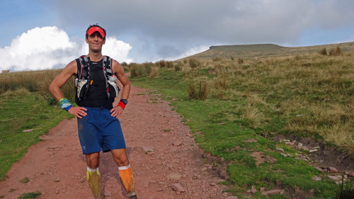
On the climb to Corn Du. Copyright Stewart Bondi (Hash name: Rambo)
Preliminaries
The race began at 5am. I was late!
The dawn glow was yet to break the jet-black of a mountain night. A light dew had gathered on the long grass making the MudClaws damp before I even toed the start line. Despite the relative comforts of a rock and roll bed in our recently acquired T4 my sleep had been unsettled. I lay awake questioning my reasons for undertaking this gargantuan task. Originally the 10 Peaks had been cause to a higher goal but I had abandoned that idea in the summer. I had proven more than enough to myself at the RAT 100K three weeks earlier and felt little pressure to do anything other than enjoy a day in the mountains. As I learnt in the spring, Welsh weather can interfere dramatically with best laid plans and previous experiences weighed heavy on my mind.
Perhaps my concerns derived more from the underlying premise of this race: self-navigation. I had laboriously formulated a route using Google Earth and a Harvey Mountain Map. Despite the jocular reputation amongst our family about my short term memory, it would appear I have a talent for memorising maps. As I lay wide awake on my bed I could visualise the entire 55 miles of my proposed route: the piles of stones; the saddles and spurs; the tarns; the river valleys and of course the peaks. Could I, however, assimilate my memory map with the terrain on the ground? The ultimate challenge of the mountain navigator.
Awake at 4am, fuelled on granola and tea, failure to consider long toilet queues accounted for my tardiness. A shorter course would be starting an hour later and with 200 people taking part, all told, patience was called for. Fortunately there was no mass start and race organiser, Mark, was calling out for any errant long course competitors as I made my way to the start control. It was time for a very long day in the mountains!
The Warm Up
Just to elucidate, the format of the Cliff Bar 10 Peaks is simple. The ten highest peaks of the Brecon Beacons National Park must be visited in the specified order, along with several additional checkpoints. The route is of the competitors choosing. A map is provided at registration with a suggested path covering 90km and 4800m ascent.
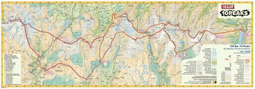
The official map of the course as produced by Harvey Maps. The short course cuts north along Sarn Helen in the middle of the map, while the long course heads to the Black Mountain on the far western edge of the Brecon Beacons.
There is no signage on the mountains. Cut-offs are fairly loose but the time limit is 24 hours. Any competitor failing to reach the second check-point by midday would be redirected onto the short course. To allow these competitors to still get an official finish we had two additional mandatory checkpoints, being the first two peaks of the short course race. So yes, we would be doing twelve peaks!
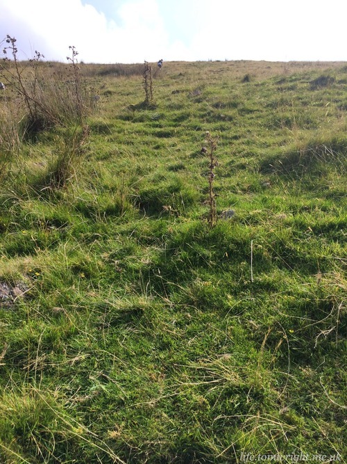
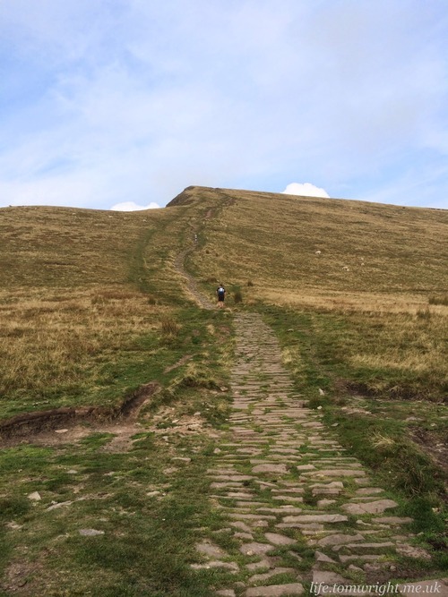
The first of these being the Hill, as the foot path sign so pleasantly pronounced, only half a mile from the start. This would be one of the longer climbs of the day, but undertaken by spotlight and with eyes still bleary in the early hours it passed quickly. Too quickly perhaps as I scored the twelfth fastest time of the day to Carn Pica.
My one memory of the climb was the incessant heat. Despite pre-dawn, the air was warm and thick. I was dressed, and packed, almost identically to the combination I donned at the RAT (other than one small technological advancement I will discuss later). This meant just a mesh vest on my upper. Yet still I was sweating!
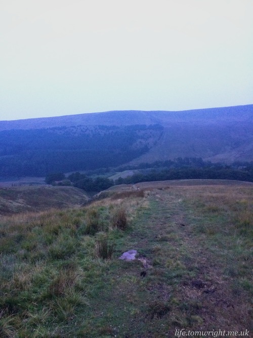
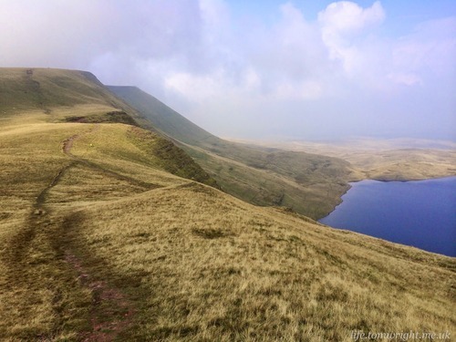
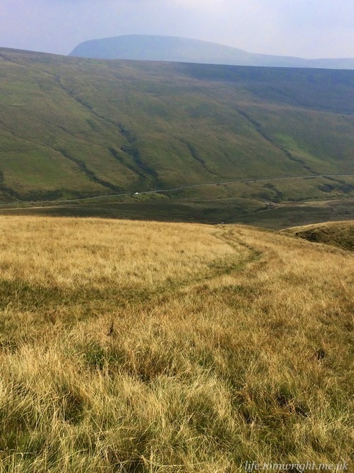
The field was stretched once on Craig Pwllfa’s peat bogs. I knew this section well, albeit in reverse, from the spring event yet still I nearly cut left straight into the worst of the bogs, only deciding at the last to follow the flashlights ahead of me on a path that circumvented the tough terrain. Then the route took us south along Graig Fan Las.
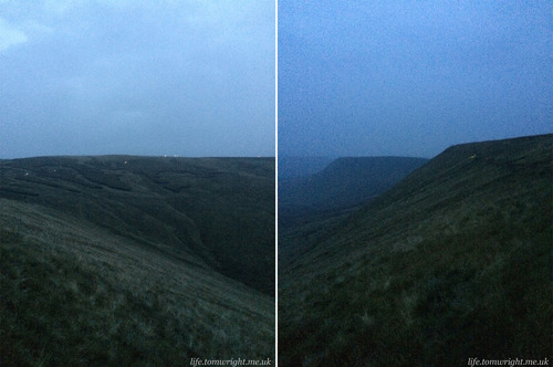
Dawn chorus on the Waun Rydd and Graig Fan Las ridges. Headlights pave the way.
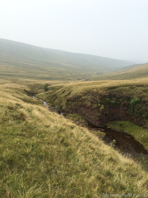
The shadows of the mountains majestically took shape around us as the light of dawn gradually filled the sky. Not a time for sightseeing as the first navigational challenge of the day called for focus. We were to take a south-west bearing across open country to the Filter House south of Neuadd Reservoir. The provided map gave little clue other than a direct line drawn from the point we would cross the Beacons Way to the reservoir. I chose to cut left at a pile of stones and find a path that followed the large gully cut into the hillside by Nant y Gloesydd. As I hit the stones I was dumbfounded to see all the runners ahead of me following the Beacons Way north-west. Perhaps people were more focussed on jockeying for position than watching their compass? Although the lie was too level to give any indication of where the reservoir was, and despite the path looking very untrodden, I stuck to my plan. Soon the path became steep, and I was hugging the gully, moving at quite some speed.
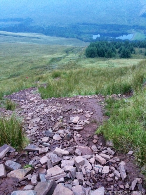
On direct course to the reservoir with a good view of the climb to Trig 642 ahead.
Looking back no runners appeared to have followed me. As I approached the reservoir I saw runners coming in from the north. I had jumped a considerable number of places, gathered huge confidence in my navigational ability and opened up the doors for further off-piste exploration throughout the day. I couldn’t help but grin at this minor accomplishment so early in the race.
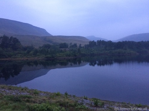
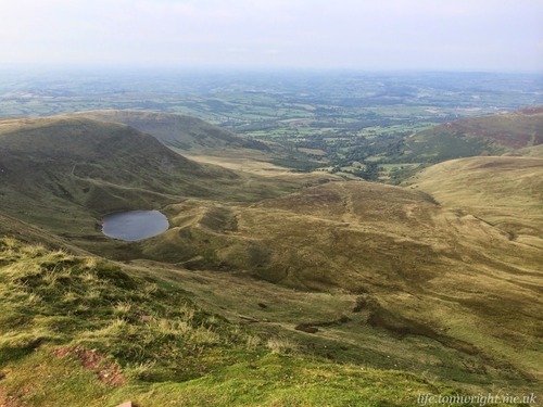
Still of the morning on the reservoir and a first glimpse of the Fan rising up in the distance.
The next compulsory checkpoint was trig point 642, followed by Rhiw yr Ysgyfarnog ridge. Familiar territory, although, unlike my previous excursion, visibility was more than ten metres and I welcomed the view across Pen-y-Fan. It was another tough climb from reservoir to ridge, with some uneven terrain and rock scrambling near the top.
The loose rocky climb to Trig 642. Runners already quite dispersed.
A female competitor, Michelle Bowen, stormed past on the climb. I was on her tail to the col at Bwlch Duwynt with intent to reel her back in on the fast descent to the first checkpoint south of Storey Arms. However she moved exceptionally fast on the downhill showing adroit control of the terrain and was all set to leave the checkpoint when I arrived.
I got that eerie feeling of quiet that I experienced at early checkpoints in the RAT. I had come here for a day out on the mountains yet I sensed in the space of 2 hours, with one brisk ascent and a wise navigational decision, I had landed myself unintentionally in the competitive end of the field. Surely that would all change, as the real challenge began with our first official peak.
Peak 1. Fan Fawr at 734m. Arrival time 07:55
First climb and not a path in sight! Riding high on my earlier nav decisions I banked left of the steeper knoll heading for a herd of sheep in the hope they would have worked some tracks into the tuft laden and overgrown vegetation. Learning on the run I soon discovered that the vibrant greener looking vegetation indicated water and was best avoided. As the mountainside plateaued I saw the official track running up a much steeper second ascent way off to the right.
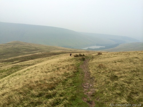
Looking back to Beacons Reservoir. I chose a slightly longer route south of Bryn Du - the small knoll on the left middle of the photo.

Steep scramble to the plateau of Fan Fawr.
The relief of a terraced dirt track was short lived as my legs showed the first sign of fatigue on the short steep climb. I adopted the ultra crouch with hands on quads and pushed slow and steady to the summit. As with all the western peaks the cairn teasingly sat further back on a gradual rise. Sucking in the cool air I had bagged Fan Fawr. The early morning cloud was gradually lifting and the views of the reservoir satisfying.
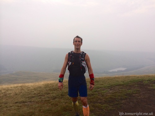
One down… nine to go! On the summit of Fan Fawr
Peak 2. Fan Llia at 632m. Arrival time 08:39
On the aerial images the landscape between Fan Fawr and Fan Llia looked remote and desolute. It was a relief to discover the path was in fact well trodden and there was no need to take bearings. This should have been one of the easier peaks but after crossing the three rivers I really struggled on the ascent to the Beacons Way. The terrain was hard work with a slow walk at best as my energy waned. Following the hefty slog to Fan Fawr I also experienced a few twinges of cramp in my calves.
Visibility helped considerably with the bearing for the crossing of Nant y Gwair
After the crossings I lost the path and several times altered course trying to follow a sheep track that soon faded into undergrowth. The other runner had taken a more direct line using poles to push through the undergrowth. He was a distant figure on the rising ridge. Once on the official track with a gradual climb to the summit I had little desire to run. Worse still, I contemplated switching to the short route at the forthcoming checkpoint. The downside of doing the extra peaks at the start made the temptation of stepping down all too accessible. As with the unexpected cramp, I put the fatigue in my legs down to the short recovery time since my inaugural 100km. Or was it just the 6,000 feet of tough ascent we had already faced this morning? Burying the doubts so early in the day took a lot of inner searching.
Fortunately a swift and comfortable descent from Fan Llia to the checkpoint, which saw me catch the other runner, put my mind at ease. I had chosen a slightly longer, and more gradual, route following the Beacons Way which bought me out just beyond the checkpoint. I believed the shallower gradient would allow me to maintain controlled speed, and I would hit the bridge across Afon Llia rather than tackling the water.
Peak 3. Fan Brycheiniog at 802m. Arrival time 11:57
Probably fitting that the most difficult peak to pronounce (just) was also the longest peak to reach.
A change of scenery crossing Nedd Fechen on the Roman Road, Sarn Helen. Fan Nedd, which will visit on the return leg, looms in the background.
First we had several uncharacteristic miles along a rubble strewn Roman Road (Sarn Helen), over some open moorland and finally through limestone country to the third checkpoint.
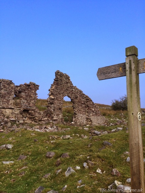
Ruins on the track to Penwyllt and the checkpoint housing our drop bags.
My mojo had returned as I put distance between myself and the runner I had shared the first two peaks with. However, the sun was now sitting high and the heat began to bake the exposed rocky terrain. I was begging to get back onto the cooler high ground. A further challenge came from an unexpected source - cattle! Not only were they reluctant to move from the main path, but they were also protecting young, and strange calls echoed across the landscape as a warning of our imminent arrival. An irrational bovinophobia just strengthened my desire to get off this alien landscape and back to fell running.
Another quiet checkpoint. But this one had food. Hot food! Despite the rising heat of an adventitious Welsh morning I was keen to savour the pasta and red on offer and foiled by warm tea I tucked into two helpings. There was an impressive array of cakes but I was steadfast with my low sugar nutritional plan.
At the same time I embraced technology. I had stowed a portable USB charger in my drop bag, which was waiting for me here. My plan was to charge my Ambit for the duration of the long climb to the third peak in the hope this extra juice would extend my watch’s life for the remainder of the course. I also had plans to change my socks, switch to some dry wrags and grab two rounds of marmite sandwiches from the bag.
However, plans were thrown into turmoil as not one, but ten other runners appeared in quick succession at the checkpoint. The fantastic staff dishing up the pasta had been quick to affirm I was in thirteenth place. But of course, I reminded myself I was here for the sights and the challenge, not to race so was content to sit back and enjoy the spread of food. Yet as the runners hurriedly switched their kit and departed with purpose a competitive urge came over me to at least attempt to maintain my position.
So I guzzled down a few extra spoons of pasta, slurped my tea, grabbed a slice of orange, expressed my gratitude to the staff and tucked in behind the lead group.
Cutting out a wide switchback of the Beacons Way we took a bearing north west over a little hillock and down some steep fields. I had planned a little short cut here around the back of the church, past the derelict pink walled Tafarn-y-Garreg inn, and over a little footbridge. It avoided a farm and possibly saved a few hundred metres. Crucially, it worked! Despite the heat, and growing fatigue my navigation brain still seemed to be alert.
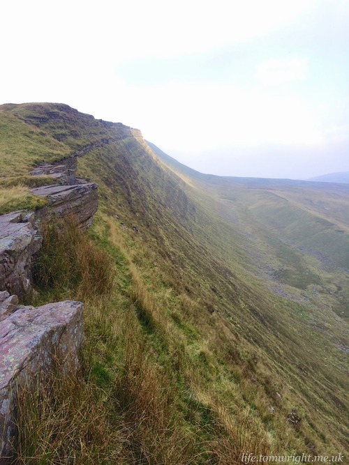
Looking over the edge of the steep eastern scarp of Fan Hir
Time for some serious ascending as we took a very steep path up the spur on to Fan Hir ridge. This was far harder than I had anticipated and I found myself stopping every hundred or so steps to catch my breath. My legs occasionally cramped up. I had been sweating heavily all morning and suspected I may have some salt deficiencies. I attempted to consume a salted Chia flapjack followed by a marmite sandwich but both were so dry I found myself spitting bits out. A few of the younger competitors in the group that departed the checkpoint were soon distant dots on the skyline. Unfortunately what I thought was the final summit was in fact a smaller peak at one end of a deep saddle. To confound my situation the descent was painful on the knees and quads.
On the plus side, the ten pound USB charger had worked. I had carried it, cables and Ambit in a sandwich bag for fear of sweat or other moisture penetrating any connections. Now with the watch back to 80% charge I was content my watch would accompany me all the way to the finish without going to sleep. So I stashed the accessories away in the bottom of my pack.
Climb to Bwlch Giedd with Fan Brycheiniog behind and Llyn y Fan Fawr down the the right.
I chatted to another runner on the final climb to the peak. He was likewise frustrated by cramp which he had never experienced in his training on these very mountains. I felt somewhat relieved that it was not just me and an experienced local fell runner was facing similar issues.
It took 75 minutes to travel 3.25 miles with just shy of 2000 feet ascent. The terrain was well walked and hard underfoot but after the initial climb the slope had been gradual. At least with clear blue skies the panoramic rolling views of the mountains had been awe-inspiring and I reminded myself repeatedly how lucky I was to experience this majestic terrain.
Peak 4. Bannau Sir Gaer at 749m. Arrival time 12:12
This swift out and back to Picws Du allowed opportunity to eye the opposition. Appearances were giving nothing away and I felt uncomfortable at how strong those in front of me looked. Of course everyone exchanged encouragement or at least proffered a smile in acknowledgement of our shared experience.
Looking west to Picws Du on Bannau Sir Gaer
The descent was back to tuft laden, boggy, mud riddled terrain while the ascent from the col was a short steep hard packed path. A bank of low cloud moved in during the ascent and the air temperature dropped instantly. While a brief respite from the sun was welcome the temporary lack of visibility was disconcerting and made me appreciate how very different the day would be if I was navigating in cloud.
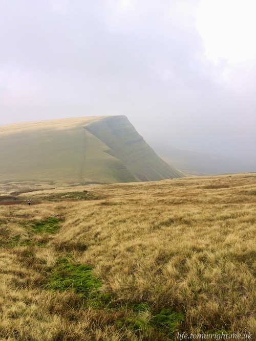
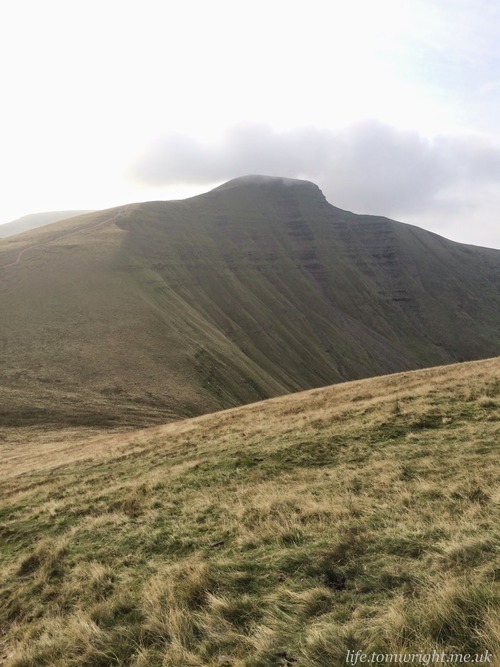
The summit was a milestone. The furthest west we would travel across the Brecon Beacons today. The horizon was too hazy to make out the Fan far off in the distance but a black shadow loomed closer. An omnipresent shadow lingering in the corner of the eye since reaching the ridge of Fan Hir. The steep imposing western scarp of Fan Gyhirych awaited.
Peak 5. Fan Gyhirych at 725m. Arrival time 14:12
Before tackling the steepest climb of the day, the marshall advised us we had one little hill to combat.
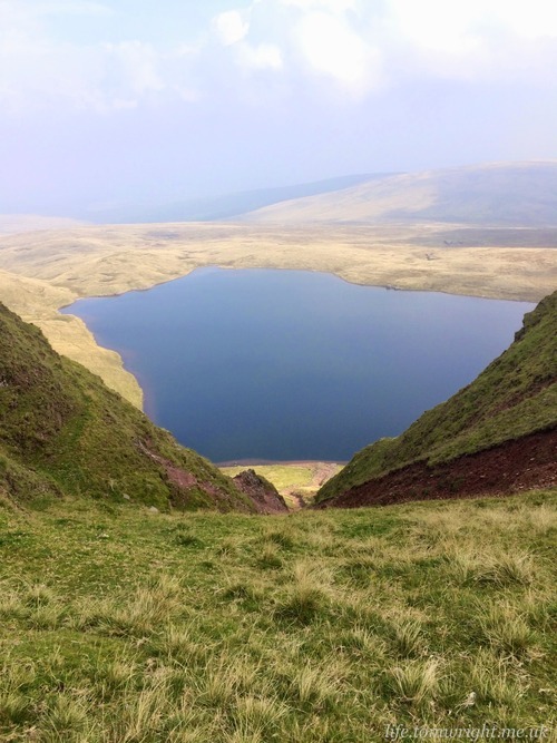
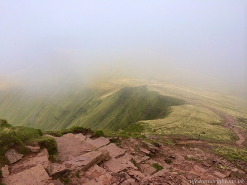
Looking down at the tarn from a large chasm at Bwlch Giedd. This was NOT the way down!
The rocky descent. Fortunately the path ran straight alongside the tarn allowing perfect opportunity to cool my head.
A steep rocky descent led down to the calm waters of Llyn y Fan Fawr. I dunked my head several times in the icy cold water. A brown film lapping at the water’s edge made the prospect of drinking it less appealing. I hoped my bottle and bladder would see me through to the next checkpoint.
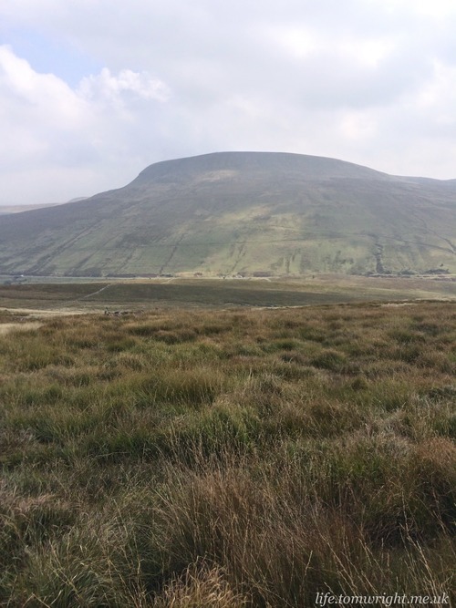
On the track heading for the lay-by where those cars are parked. The mountain looming in the background!
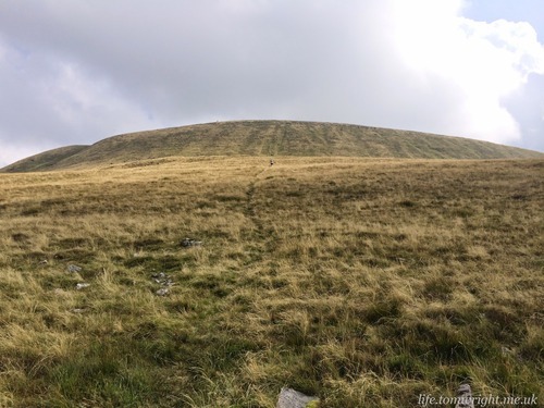
A small path wound along the of edge of Nant-y-Llyn river leading to the foot of the hill. The dark shadow of the mountain loomed behind. It was a spectacular sight - the David and Goliath of the Brecon Beacons. Fan Gyhyrich only stood 725m high but appeared to be so much higher.
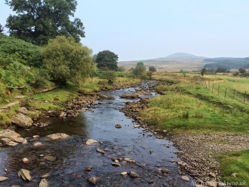
Gentle flowing waters of the Nant-y-Llyn river.
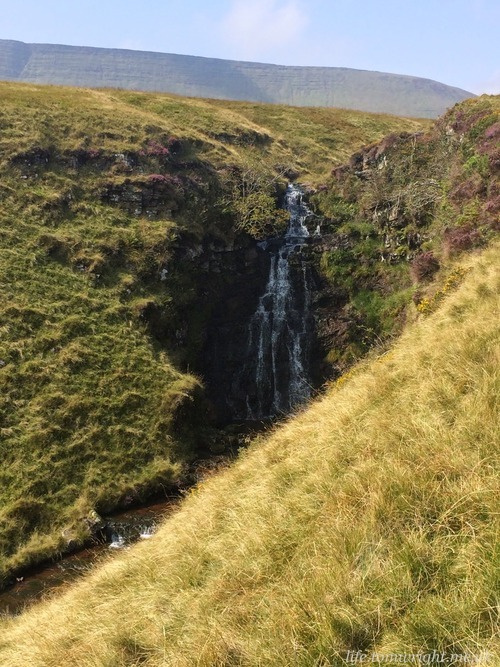
A few fresh faces followed close behind me now. As the descent steepened our travails were rewarded with picturesque waterfalls in flow despite the long spell of dry weather. I could only imagine what these rivers would be like in flood by the depth of the gorge they had cut through the landscape.
Time for focus. This section would probably be the toughest of the day. Open country, overgrown terrain, and just a few sheep tracks to follow - if they could be found.
I sought just such a track across the stile and right of the stream at the foot of the hill. It had been visible on Google Earth but with wild grass hugging my knees a path was hard to locate. An old fence post served as clue and soon enough a narrow walkable track revealed itself. I called the other runners who were across the stream fighting vegetation and they joined me. We lost the path several times on the slow hike and hit a few boggy sections but finally surmounted this hill that could have so readily been a peak and descended to the checkpoint.
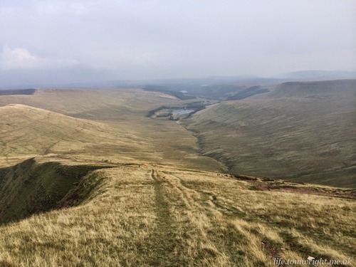
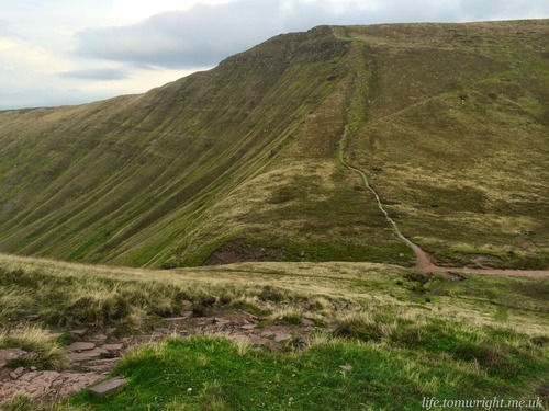
Looking back to Fan Brycheiniog from the top of the hill. The gorge of Nant-y-Llyn cutting through the landscape.
First full view of Fan Gyhyrich. The checkpoint awaits in the lay-by at the foot of the climb. The tufty terrain in the foreground gives a good indication of the footing over the hill.
I filled my bone-dry bladder and bottles and then took charge of several packs of Clif shots. My store of dry food was no longer working. Energy was depleted and in the hottest part of the day my mouth was too parched to chew on bread or bars. So, with twenty miles to go, I adapted my nutrition plan in favour of quick release sugar. I couldn’t see how else I had any hope of ascending the mountain that stood in my way.
The reputation of Fan Gy’s western scarp had preceded it. Maps don’t lie. Crammed contour lines. This was a very steep prospect! The initial clamber bought back memories of my navigational errors on the Black Mountains in April. No footpaths to speak of. Only the keenest, or craziest, hikers would tackle this challenging ascent surely! My legs were screaming and this was a far cry from ultra-running. I would attempt to climb 50 short steps, then rest, with hands on knees and curse. Walk, scream, repeat! That was the new method.
The slope was tough, the underfoot terrain just added to the anguish!
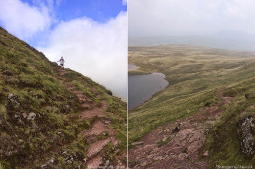
The slope levels out ahead of the final 100m climb.
On hands and knees scrambling to the top of Fan Gyhyrich. The toughest ascent of the day (so far)!
The fact the final 100m was covered on hands and knees was affirmation enough. In fact following the form of those ahead of me by adopting a scramble over the last ascent I couldn’t help but wonder if this would have been a more efficient way to tackle some of the earlier climbs we had encountered. For a short brief spell the pain in the legs subsided, the fatigue was stymied and I actually started enjoying myself.
Five peaks down. Five peaks to go!
Peak 6. Fan Nedd at 663m. Arrival time 14:54
I had several navigational tactics in mind for Fan Nedd. Bearing west off the summit was not one of them as I made contact with the red road far earlier than expected and put a few hundred metres onto my route. My first navigational error of the day which I attributed to the exhaustion of the climb just undertaken. On a positive I could just make out Pen-y-Fan on the hazy horizon. It was getting closer.
Fan Nedd awaits centre of picture. I chose to take a sheep track on a direct bearing along the edge of the mountainside rather than following the ridge to the northern trig.
I was keen to get back onto softer ground and deviated right on a small path that followed a farm wall to the foot of Fan Nedd. An unexpected bog found me waist deep in muck and stinking of more than just sweat! An unfortunate stench that lingered on the air for quite some time. Several other runners were following the ridge line to the northern cairn. I chose a direct bearing across the mountainside via sheep tracks. The path repeatedly petered out into more overgrown tufts but my legs were grateful for the slighter gradient. By the summit I had made ground on several other runners. The descent was swift and steep. I was grateful for an emergency checkpoint that had been set up by Mountain Rescue offering water. My supplies were nearly exhausted!
Peak 7. Fan Frynych at 629m. Arrival time 16:11pm
"The Romans built terrible roads", I kept telling myself as my tight muscles struggled on the rubble strewn track that wound north west. Perhaps 2000 years of torrential Welsh climate was more cause for the protrusions that jutted out and repeatedly caught the sides and souls of my feet. This was not good terrain for MudClaws and I felt several pangs of pain.
Pen-y-Fan and Corn Du almost within reach.
Peak 8. Pen Y Fan at 886m. Arrival time 17:54
Back on a Roman road. This one well modernised with stone-pitching. The same road on which I had rediscovered some purpose during the torrid Summer 50 as I pulled myself back from the brink of a DNF. Contemplating how excruciating that day was really put the current scenario in perspective. Yes the legs were tired but the weather was still fair with clear skies. Exiting the station I passed a couple of long course runners I didn’t recognise and my thoughts wandered briefly to my position in the field. This had been of little concern on the western section as numerous runners overtook. Maybe I was hovering in the low twenties. I had to shake off my mind’s meanderings and concentrate on the job in hand, one summit at a time.
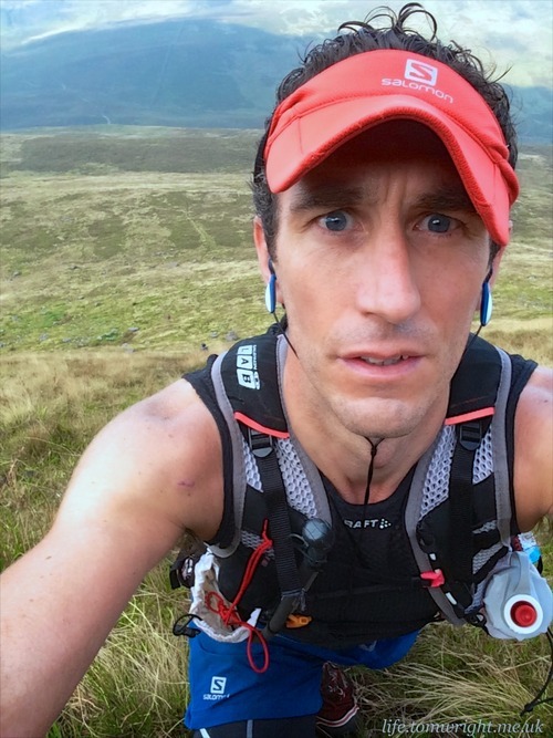
With so many other competitors around me now I was reluctant to show weakness with the “walk, scream, repeat” method and stuck out the climb to Corn Du at a steady slow pace. Only stopping briefly to hydrate my parched throat. A very dextrous non-competitor, who I discovered later was Rambo, came bounding down the hill towards me briefly stopping to take some photos of my suffering.
On the ascent to Corn Du. Our first peak from earlier in the day, Fan Fawr, looms in the shadows. Copyright Stewart Bondi (Hash name: Rambo)
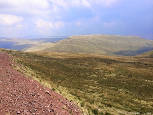
At the crossroads I had the option to bank right to the col and skip Corn Du entirely as it was not a mandatory peak. I decided the view would be far more rewarding going to the summit and why not add a thirteenth peak to the journey.
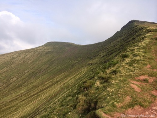
Corn Du and Pen-y-Fan
The valley to the north with Pen Milan on the left
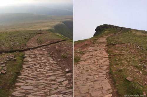
The final path up to the summit of Corn Du
From Corn Du it was a simple matter of a short descent where I attempted to generate some speed to carry me up the slope to Pen-y-Fan. Gravity carried me about five metres before my legs stopped dead and it was back to the slow plod. It was a great relief to finally reach the summit of the highest peak which had looked so distant when I spotted it in the haze from Fan Nedd.
Peak 9. Cribyn at 795m. Arrival time 18:16
It was was just under a mile to Cribyn following a steep rubble path into the col and a stone-pitched path up the other side. Occasional low cloud swept through but rarely long enough to conceal the target and spectacular views just kept flowing.
Stoney descent from Pen-y-Fan while Cribyn hides in the clag
Down the valley to the Neuadd reservoir which we had passed in the early hours of the morning.
The ascent to Cribyn
Gazing up at the imposing hundred metre climb to Cribyn I sought distraction. My phone had reception so I decided to phone the family and let them know my progress. The girls were sat on the sofa, watching athletics and tucking into pizza. The thought was tempting but hey, I was in the mountains and it was awesome! After a quick chat with our oldest daughter we said our farewells and I set off with purpose to yet another summit.
Pen-y-Fan from the climb to Cribyn.
Peak 10. Fan y Big at 719m. Arrival time 18:37
How fitting that my adventure should end on the peak that I battled so valiantly with on my last visit. That peregrination was conducted in dense clag which hid the true summit as we followed a signed path around the perimeter. It shouldn’t have come as surprise that I faced one last steep climb to bag my final peak of the day. At least the path was well trodden with a well pitched switch-back. My legs welcomed this indirect but less intense avenue.
Just one more climb to go! Fan-y-Big awaits.
So, eleven hours after I had set off from Storey Arms on the first official climb to Fan Fawr, I had finally conquered the ten peaks! It had been an awe-inspiring experience. The landscape never ceased to impress and clear skies rewarded my efforts with sweeping vistas at every turn.
It was undeniably painful and the hardest challenge I have ever undertaken. I had climbed just shy of 15,000 feet, my legs screaming in pain but never faltering.
I took trust in my hired timing chip but as added proof here is a selfie on each of the summits in turn. Clear skies on every one! Who would have predicted that in South Wales?
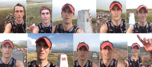
Fan Fawr, Fan Llia, Fan Brycheiniog, Bannau Sir Gaer, Fan Gyhyrich, Fan Nedd, Fan Frynych, Pen-y-Fan, Cribyn, Fan-y-Big. 10 Peaks Conquered!
The Run In
All that was left to do was attempt to traverse the final six miles back to Talybont reservoir in less than 90 minutes to go sub fifteen hours. All energy was spent and I adopted a run/walk around Craig Cwareli. As much for caution as the uneven track cut close to the vertical cliff face. The sun was low in the sky now and whispers of clouds hugged Pen-y-Fan. I thought of other competitors, the walkers, still way out on the western fringes of the course with a whole night of trekking ahead of them.
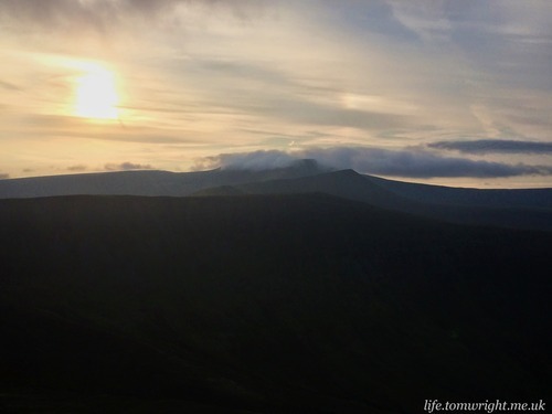
Pen-y-Fan and Cribyn silhouetted against the setting sun.
In the peat bogs I was reduced to walking. I knew from Carn Pica it would be downhill all the way to the finish so convinced myself I was banking some energy, and pain, for the final two miles by taking it easy over the bogs. I had time in hand.
High above on Carn Pica, the setting sun painted glorious hues across the valley interspersed with long shadows from the surrounding mountains. Talybont reservoir was in sight and it was downhill all the way. My legs were tight on the near vertical descent and I took it steady but as the gradient levelled I let gravity take hold and my stride increased. Two fellow competitors were in my sight. Weaving down the track off Twyn Du I caught one of them. Then for no reason I had a desperate urge to go to the toilet! Something I hadn’t done for much of the day and not the first time such an indiscretion has come over me in the vital final throes of a race. I had little option but to attend to the call of nature.
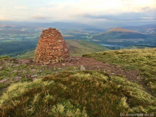
The familiar sight of Carn Pica cairn as late afternoon light and shade illuminates the valley below.
When I finally rounded the farm I saw several runners now making their way across the reservoir but despite running as hard as my legs would allow over those last few hundred yards I wasn’t going to catch them.
The slight glimmer of a race on that long descent helped pull my time inside fifteen hours. Thanks to my late start I also leap-frogged the runners I was chasing and finished in thirteenth. The same position I found myself in at that hot feed station nearly ten hours earlier. It had been a very long day. Bed was calling but not before a tepid, but still much appreciated, shower, hot food and, of course, the obligatory local beer.
This was a very well organised event. The checkpoints were admirably stocked with Clif supplies and the hot and cold cornucopia of provisions at the hot feed station in Penwyllt were appreciated. Served up by a team of volunteers all dressed to amuse I should add! I was especially touched to see all monies from sales of goodies (and photographs) going to charity. The team at Ten Peaks put on an unsurpassed challenge, for me, and I couldn’t recommend this enough.
I feel my time on the Brecons has been served. Thank you 2014 for the memories!