Written by Jim Tinnion - http://midlands-fell.blogspot.co.uk
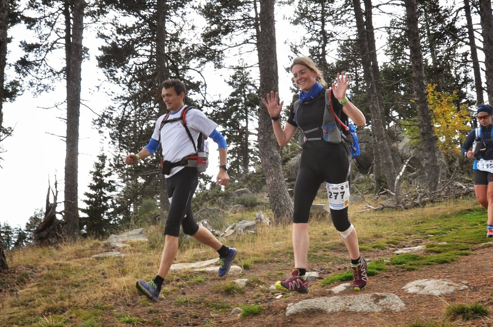 |
| Running down into Pyrenees 200 an hour into the event |
For this year's foreign race I picked the new 100 Miles Sud de France race. It's got a very simple premise. Start at the French Athletics Federation's altitude training base at Font-Romeu (that's where Paula Radcliffe lives) and run east along the GR10 trail to the sea. Nice.
My aim was to run with Zoe at a very comfortable pace with a view to getting some tough miles in before the Spine. We'd be relaxed about it and just see how far we could get.
The first 20km were fairly standard for a continental race, nice easy trails and softish ground which let the 324 runners in the field spread out a bit. We passed the altitude training camp after a mile's steady climb and then it was gently downhill through the resort of Pyrenees 2000 and on more nice trails to reach the Citadel (castle) at Mont-Louis. There we joined the GR10, and a bit of up and down led us to Plan ès, the first feed station. To be honest the food at intermediate checkpoints was very disappointing with just a few cakes and so on, and we ended up relying almost wholly on what we were carrying.
Planès marked the start of the mountainous ground. We slowed to a steady walk and started the warm-up climb. This two-parter took us up 400m to a traversing path at the 1,900m level which went along one side of a valley through very rough and boggy pasture and past a heard of cows. We crossed the river and passed an informal aid station at Refuge de Riberola before descending slightly on better ground to 1,600m and the start of the the big climb to Col Mitja. This started easily enough on a good 4x4 track and we spent the time chatting away to a lovely gentleman from Brittany. Just before dark (so about 4.5 hours in) it started to rain. I guessed from those around us that it might be quite heavy and so we put our cags on and continued up into gathering gloom. After a long climb (the top's at about 2,360m, so there was 960m of ascent here) we were heartened by a small group of local supporters who were whooping and banging drums up on the col.
I was pleased I wasn't hanging about up there as we ran steadily down a rough track into the next valley. I felt a little cold, especially as I was waiting for Zoe occasionally as she descends a little more tentatively than me in the dark. Anyway we were soon down at the Refuge de Ras de Carança, where we were able to get inside out of the rain and put our power stretch fleeces on. There was a little food here (although it was only advertised as a water point) and we got some cheesy biscuits and some Genoa cake down as we hiked on.
The next section was a flattish but very rough yomp on sometimes indistinct paths through trees to reach the foot of the climb to Col de Pal. Bottom to top this was a bit less severe than Mitja, with 470m of ascent. At the top of the col there was another group of supporters, so we thanked them and passed on up - this is one of several places where the GR10 climbs to a col and then carries on at high level, sometimes climbing, across a hillside to cross a ridge. The path was good again here and we had soon crossed Serre de Caret and were descending steeply towards the valley. We weren't making great time as Zoe again struggled with the terrain in the darkness. The descent became less steep as we neared the valley bottom and turned to do the final 3 km to the checkpoint at Mantet. As we crossed the river we stopped to take off our cags. The village seemed quite a long way away up the next hill but in reality we were passing the first building in five minutes. We stopped for a moment to photograph a striking black and yellow lizard which we found in the lane. It must have been cold - certainly the lizard didn't seem up for any rapid movements.
The Mantet checkpoint was another where there was supposed to be food, but again there was really only cake and biscuits. Beggars can't be choosers though. We pushed on and started the short climb (250m or so) to the Coll de Mentet. This seemed to zigzag a lot more than on the race map, and dragged on even though we were going quite well again. At the top we passed a marshall and started down a series of tricky paths which repeatedly (and sometimes slightly confusingly) crossed the road, before we finally joined the tarmac for the last few hundred metres to the "Base Vie" (main aid station) in the village of Py. This was at 43.5km and we'd already done 2,220m of ascent (D+) and 2,970m of descent (D-). I checked the cut-off on arrival and we were told 3:30am - "good", I thought, "we've plenty of time to regroup".
We took a while to strip off wet stuff and change socks etc. I dressed my foot as I had a blister (probably from some gravel - otherwise my RaceUltras were supremely comfortable and surprisingly grippy). We ate a bowl of plain penne with a little cheese and had some noodle soup. Yet again though there were no hot drinks. I was seriously in need of a tea or coffee... We were suddenly brought round as the checkpoint lady told us there was ten minutes to the exit cut-off. This was now 3am! I'm not sure how this happened, but basically we had to get the hell out of Dodge without the brief snooze I'd been looking forward to.
We got out PDQ and started the next section, climbing onto and over a ridge on very rough tracks and then picking up a good 4x4 track to climb the final 2km to the Marailles Refuge. I was out on my feet at this stage, falling asleep whilst still walking (or staggering) upwards. Zoe snapped me back round a few times and eventually I popped a Pro Plus and checked the map. Nearly there, so I just kept plodding. There was a Gendarmerie van at the top (quick scan of the chip in our numbers) but more importantly the refuge was very close by. We got in there but I was too tired to eat. Zoe sat in front of a roaring open fire while I went upstairs and lay down for fifteen minutes. I don't think I slept but I did close my eyes and get off my feet for fifteen minutes which helped.
We grabbed a cup of bouillon each and then started off towards the next checkpoint. Pretty much straight away we were on a rising traversing path which alternately crossed boulder fields and then went through sections with lots of wet tree routes and rocks sticking up from the surface. It was impossible to make quick progress. The gradient eased but even on the level we were doing well to make 3-4 km/h. It got light as we crossed a river barely 4km on from the refuge, having been moving for well over an hour.
We then followed the GR10 on a contouring path around the west side of Pic Canigou. The path was up and down, mostly on either very rocky ground or across boulder field, for the next 5km before dropping down in a beautiful but extremely rough corrie. I had another sleepy spell here and had to resort to another Pro Plus in the absence of any other caffeine source. We made slow but steady progress, leapfrogging a nice French guy who was quicker than us on the flat bits and downhills but much slower on the climbs. Eventually we walked onto a decent 4x4 track and reached the Bonne Aigue checkpoint, just as the morning sunshine hit it. We didn't stop.
On from here there was a steep climb up a ridge to regain the height lost down the corrie. I was going well now and set the pace, leading Zoe and the French dude on up. At just above the 2,000m contour we turned and began to traverse right handed again, on familiarly poor ground, eventually reaching a point where we could see a small lake and the French Alpine Club hut at Cortalets in front of us. We'd discussed the time situation on the way over but felt we should press on in the hope the ground would become easier and we could make the cut-off at the next Base Vie at Arles-sur-Tech. I texted our friends who were supporting us to let them know we would be later than anticipated but were still going.
Fifteen minutes later we arrived at the checkpoint. The staff told us we were the last in the race (actually I knew there was at least one guy behind us). There must have been a lot drop out behind us already as we hadn't been passed by many and there were lots behind us descending to Mantet, but maybe they'd fallen foul of the moveable Py cut-off? The staff were keen for us to drop here, promising transport to the finish would be leaving shortly.
I had a brief chat with Zoe. She wasn't really enjoying the terrain and was afraid that we would not be able to do the 22km to Arles in the 4.5 hours we had available before the Arles cut-off and have a meaningful rest / refuel when we got there. I couldn't really see the point of flogging ourselves down to Arles. It was 2,000m of descent more to put in our legs, and we probably wouldn't be in a state to continue even if we got in and out of the checkpoint in time. I could probably have speeded up a fair bit if I'd gone on alone, but I didn't want to abandon Zoe (I'm the French speaker) and so we decided to drop together. We'd covered 66km (4,000m D+ and 3,630m D-) in around 21 hours. Little more than 3km/h, but then that's perfect practise for the Spine Race! What's more there were a lot of positives to take from the event and no real negatives - I'd be able to train again almost immediately, rather than suffering the usual post-hundred 6 week layoff.
There was a bit of a cock up with vehicles etc., and in fact we would probably have been better to run out to Arles as we had to wait nearly four hours for a lift to Argeles, but otherwise the event was well organised and I would come again. Any miscalculation was mine in underestimating the difficulty of the terrain and the effect that would have on Zoe's pace...
We had a great time in France thanks to Keith and Pauline (Mercia stalwarts) who moved out to Foix in Spring and opened their house to us for the week, also supporting us on the event.